Yellowstone Lake and Other Lakes in Yellowstone
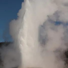
Quick quiz: How many lakes in Yellowstone National Park? According to the Park Service there are over 600, with a combined surface area of about 107,000 acres. About 5% of Yellowstone’s surface is water. The Park is famous for its incredible array of geysers and hot springs, but its cold waters are even more extensive.
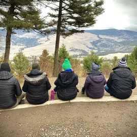
The four biggest lakes in the Park, making up 94% of the water surface area, are Yellowstone Lake, Shoshone Lake, Lewis and Heart. These are all magnificent lakes well worth visiting. Lewis and Yellowstone Lake can be accessed by road while Shoshone and Heart are wilderness lakes. I’ll give some details on each lake.

All of Yellowstone’s big lakes can provide great fishing. Shoshone, Lewis and Heart all were long ago stocked with lake trout, browns and rainbows, which are non-native, but amazingly these lakes never had fish before this stocking program. Yellowstone Lake, however, hosted a thriving population of cutthroat trout before people got there – trout that most likely arrived there originally by swimming over the Continental Divide!
SEE YELLOWSTONE WITH A PRO Of course the waters of Yellowstone
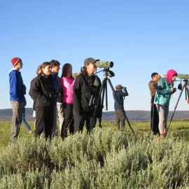
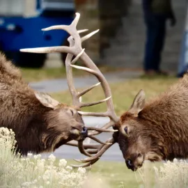
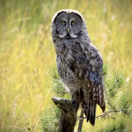
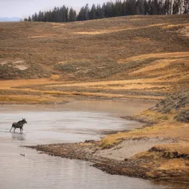
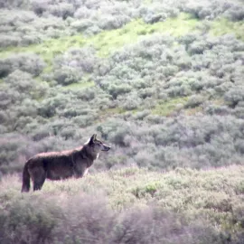
attract plenty of wildlife. Around 42 species of wildlife eat native trout, including birds such as eagles, cormorants, loons, gulls, terns, osprey, mergansers and pelicans. The shallow lagoons along Yellowstone Lake are great for spotting waterfowl like ruddy ducks and goldeneye ducks. I’ve seen river otters in 3 of the 4 big lakes. Moose, elk, mule deer, and bison all frequent the lakeshores, meadows and forests.
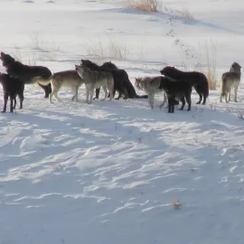
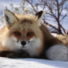
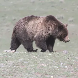
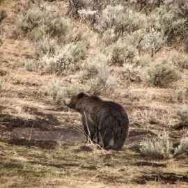
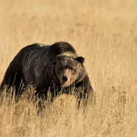
Grizzly bears and black bears are also common visitors, some of them catching fish in tributary streams in the spring. Wolves, coyotes and foxes are abundant here, especially along the north shore of Yellowstone Lake, and I have heard stories of mountain lions seen swimming across a narrow part of that lake.
Shoshone Lake
Shoshone Lake extends across 8,050 acres and sits at 7,795 feet of elevation. This spectacular sheet of water drains to the Pacific Ocean – it’s found on the west side of the Continental Divide, and its main outlet – the Lewis River Channel – flows into Lewis Lake, the Lewis River and the Snake River. Here you find the largest road-less lake in the lower 48 states.
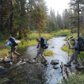
It’s a magical lake. On my first visit I hiked the shortest route to reach it, via DeLacy Creek trail (about 3.5 miles), planning to camp near the lake. I arrived late in the day and walked onto a black sand beach. Suddenly I heard music – bagpipes! I stood transfixed as the backcountry ranger played a couple of tunes to welcome the sunset. Since that 1985 hike I have returned for several multi-day canoe trips to Shoshone.
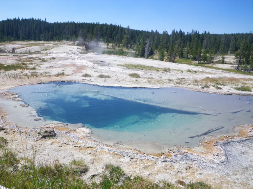
DeLacy Creek trail starts along the Craig Pass road between Old faithful and West Thumb. The only place to see Shoshone Lake from a road is a distant view at Shoshone Point along the same road. The lake is very popular with paddle-powered boaters – kayakers, canoeing, pack rafters. Numerous backcountry campsites are found along the shoreline. Shoshone has several trails around it as well as a spectacular, remote geyser basin at the west end, where you can hike amongst
geysers and hot springs with few tourists and no boardwalks.
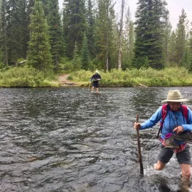
To reach Shoshone with a canoe you must paddle across/around Lewis Lake then up the four mile Lewis River Channel, part of which requires wading up the river towing your loaded canoe. I always felt like I was a throwback to the early explorers traveling this way.
Heart Lake
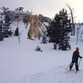
This is the most remote of the big lakes in the Park. Heart is a gorgeous lake sitting at the foot of Mountain Sheridan. At 7,641 feet it also drains into the Snake River and Pacific Ocean. The easiest access is via a 7 mile hike from the trailhead along the South Entrance Road. The hike takes you through lodgepole forests and meadows then down a long grade following Witch Creek. Witch Creek is a warm creek so keep an eye out for pools to slip into and soak away our troubles. Near Heart Lake at the foot of Mount Sheridan is the Heart Lake Geyser Basin which includes Rustic Geyser.
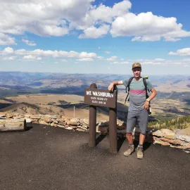
There are a number of backcountry campsites along Heart Lake. A popular side trip is the hike up to the summit of 10,308m foot Mount Sheridan. If you do the whole hike to the lake and the peak it’s 22.4 miles round trip. In the 1980s I slid with friends on garbage bags down the massive snowfield from the summit, reaching the lake in about ½ hour. I’ve also encountered a number of moose in the area including some that would not leave the trail, forcing us to bushwhack. Heart is also a good place to look and listen for loons, a rare sighting in Yellowstone. You could also bring in a packraft as another way to explore Heart lake.
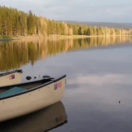
Lewis Lake
This is a lovely, inviting lake along the south entrance road. Lewis Lake is open to motorboats, one of only two such lakes in the park. There’s a small campground next to the lake. Lewis is great for a canoe or kayak when the water is calm. There’s a boat launch along the road. It’s also the access for Shoshone Lake (see above) and has great fishing for browns, rainbows and lake trout, all introduced. Don’t underestimate this lake as the wind and waves can be dangerous like all large lakes. Be sure to check out the spectacular Lewis River Canyon and Lewis Falls just to the south on your way to Grand Teton National Park.
Yellowstone Lake
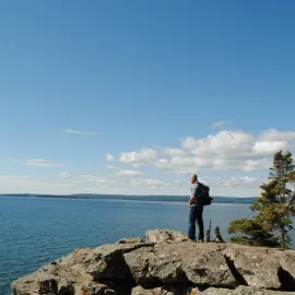
Yellowstone Lake itself almost defies description. It is so vast, so unlikely, this great wide flat clear liquid expanse in the middle of the Rocky Mountains. My first and second summers in the West I lived and worked at Yellowstone Lake Hotel, the oldest remaining national park hotel in the world. The grand old hotel occupies a bluff on the north end of the lake, a traditional meeting spot for Native Americans, trappers and explorers, and now for travelers and park enthusiasts. One look at the endless expanse of crystal clear water, its moods constantly changing, and I was hooked. I’ve spent as much time as I can at Yellowstone Lake ever since.
This massive lake, its elevation about 7730 feet, covers 139 square miles, and is 20 miles long by 14 miles wide. It has several large islands and some huge bays – The Southeast Arm, South Arm, Flat Mountain Arm and West Thumb, all big enough to be lakes on their own. The two big southern arms are really fresh water fjords, carved by glaciers that crept down from the Continental Divide. These southern “arms”, along with Flat Mountain Arm are accessible only by boat or on foot. Motorboats are allowed on all but the southern ends of Yellowstone Lake.
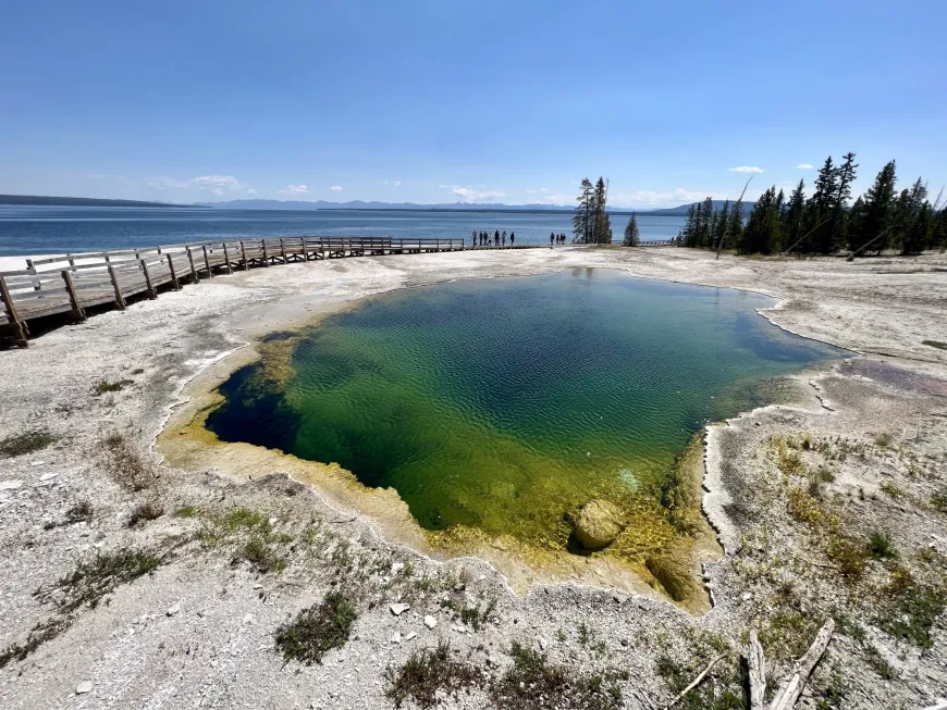
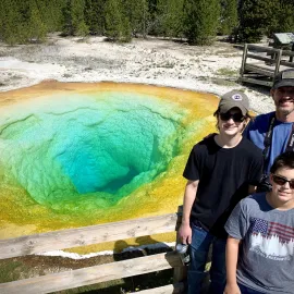
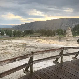
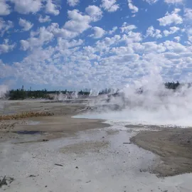
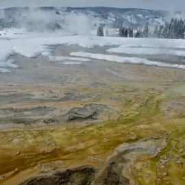
West Thumb Bay is actually a huge crater from a hydrothermal eruption 174,000 years ago. On its western shore you can visit and walk the glorious West Thumb Geyser Basin, featuring some of the deepest and clearest hot pools on Earth, as well as hot springs and geysers actually in the lake. The view across 14 miles of water to the distant Absaroka Range is unbeatable.
Other volcanic craters lie under the lake at Mary Bay, Sedge Bay and elsewhere. Nearly 400 feet deep, the lake is dangerously cold, averaging about 41 degrees F in the summer. Strangely Yellowstone Lake also has some serious hot spots, with a temp of 252 degrees measured at Mary Bay! This is due to extensive geothermal systems that simmer and sizzle in the lake bed. These geothermal vents build underwater mineral columns and attract life – sponges, bacterial mats, and fish.
The west side of Yellowstone Lake has many worthwhile spots to stop and stroll and contemplate. Arnica Creek, Gull Point Drive, Pumice Point, as well as several quiet lakeside picnic areas are all accessible, and many have black sand beaches. Watch for the fishing boats in the lake working to eradicate invasive Lake Trout which threaten the native cutthroat trout.
Book A Guided Tour of Yellowstone Driving east along the north side of the lake, don’t miss the Fishing Bridge Visitor center, with a unique collection of taxidermy native birds as well as a 3-D map of the lake bottom. Walk down to the deserted beach for a taste of Yellowstone Lake solitude and space. Further on are a variety of fascinating sites like SteamBoat Point and Lake Butte overlook, located on the edge of the Yellowstone caldera. Be sure to take a walk – guided or on your own – on Pelican Creek or Storm Point nature trails. After your hike grab an ice cream at the Fishing Bridge Store, or bunk down at the Fishing Bridge RV Park.
The southern end of Yellowstone Lake, all roadless, is the domain of big wild animals as well as wilderness boaters, campers, backpackers and long distance wilderness travelers. The Yellowstone River flows into the Southeast Arm (and out the north end at Fishing Bridge). Upstream along the river is the Thorofare region, most remote from a road of any place in the lower 48.
Lake Village, in addition to Lake Hotel, has cozy cabins, the Lake Lodge, restaurants, lounges, a great gift shop, sandwich shops etc. At Bridge bay Marina you can launch a boat, rent a boat, hire a fishing charter, or hire a shuttle boat to drop you off or pick you up along the wilderness end of the lake. There’s a large campground here too. Grant Village on West Thumb also offers camping, lodging, stores, a visitor center, restaurants and a mostly unused marina.
Other Yellowstone lakes well worth visiting include the “chain of lakes” on the south side of the Washburn Range – Cascade, Grebe, Wolf etc. All require hiking to reach them. Ice Lake is backcountry but only ¼ mile from the road. I also recommend Crevice Lake in the Black Canyon of the Yellowstone, a gorgeous round lake in a small crater. Many lakes are extremely remote and some have no trails to them. Go explore and find your own lake.
Most lakes in the park are open to non motorized boats such as SUPS, float tubes and kayaks. All boats however require a permit and must be cleaned, drained and dried to avoid spreading aquatic invaders. All park rivers except the Lewis River Channel are closed to any type of boat. However you slice it and whichever lake you pick you are in for lovely clear clean water, vast views to distant mountains and forests, peace and quiet, wildlife, and a real taste of the wet wild west.
Just Be Careful
Keep in mind all of these lakes are quite dangerous due to cold water, erratic weather and high winds that create very choppy waves. More people have died in Yellowstone from cold water drowning that from any other “natural” cause. Rule #1 for paddlers is stay close to shore and keep a change of clothing, hot drinks, cook stove and fire-starter easily accessible in a drybag you can grab if you flip your boat. And of course wear your Personal Flotation Device! Most drownings occur because someone flipped their boat too far from shore and became hypothermic before they could get out of the water. If it gets windy and choppy, stay off or get off the water and wait it out. Travel in groups of three boats if possible so two boats can aid a flipped one. If you are wondering if you can swim in Yellowstone Lake, the official Park Service policy for swimming in Yellowstone’s cold lakes is “not advised,” But it’s allowed. I have done lots of swimming in all of these lakes and will leave it up to you to check it out. I will guarantee a refreshing dip!
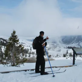
Blog post by Phil Knight. Phil Knight is Bozeman local, author, outdoor enthusiast, and
guide for Yellowstone Guidelines. For tours and adventures in Yellowstone with Phil, contact us at 406-599-2960 or
tours@yellowstoneguidelines.com
More Yellowstone Stories