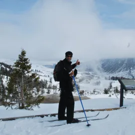
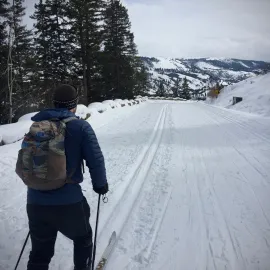
Cross Country Skiing in Yellowstone's Northeast Corner

Winter Skiing in Yellowstone
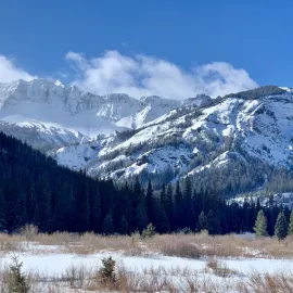
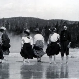
Cross-country skiing in Yellowstone is a historic winter pastime. Tons of trails run throughout the park, providing endless cross-country skiing adventures. The Northeast Corner of Yellowstone receives bottomless powder and accumulates some of the greatest snowfalls in Montana, a perfect place for your next winter vacation in Yellowstone. The Bannock and Barronette Ski Trails are a great way to break up the day and enjoy the winter season in Yellowstone.
Bannock Ski Trail
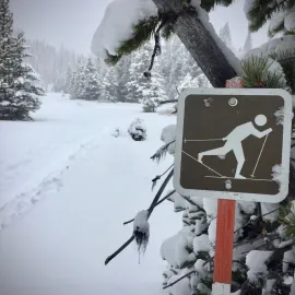
The Bannock Ski Trail is in the northeast corner of Yellowstone. The trail is perfect for beginners and advanced skiers looking to stretch their legs. The Bannock Ski Trail is a mellow 1-mile (or 2-mile out and back) trail. The route can also be extended by skiing outside the park and through portions of the Absaroka-Beartooth Wilderness. The cross-country ski trail in Yellowstone follows Soda Butte Creek and the old roadbed into Cooke City, Montana. The Bannock Indians and other tribes once used the road as a passage through the park for hunting bison on America’s Great Plains.
How to get there: The start of the trail is about one mile west of the Northeast Entrance. If traveling east (towards Cooke City, MT), look for the Warm Creek Trail sign on the left, and park in the pullout on the right a few hundred yards just after the sign. The parking lot should be marked with a National Park Service sign and a map of the Bannock Ski Trail.
After parking, follow the trail markers on a small footbridge over Soda Butte Creek. The well-marked trail is mellow, crosses open meadows, and navigates the mixed conifer forest of Yellowstone’s northeast corner.
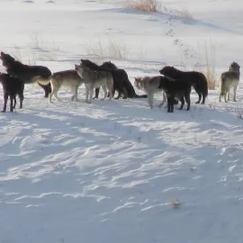
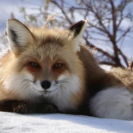
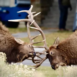
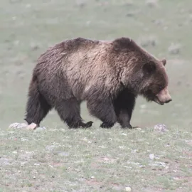
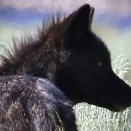
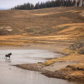
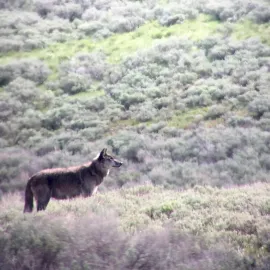
Look for animals on the trail like bison, moose, mule deer, coyotes, and fox. Follow the ski tracks to the boundary of Yellowstone at the one-mile marker. If you continue from here, the trail goes through Silver Gate, Montana at mile two, and enters Cooke City at mile 3.
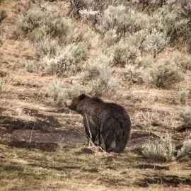
Once in Cooke City, the trail is open to snowmobilers. Don’t worry, you’ll hear them coming. The trail holds snow well into the spring, so be sure to carry bear spray if enjoying a late-season ski!
Bannock Ski Trail Information:
- Length: 2 miles – Out and Back
- Rated: Easy
- Elevation Gain: Minimal – About 130 feet
- Other: The Bannock Ski Trail is not groomed and skier-tracked. The trail is obvious, but pay attention to orange “blaze” markers, especially in the open meadows.
- Downloadable Map of the Bannock Ski Trail
Barronette Ski Trail
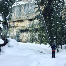
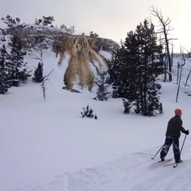
Jack Barronette is a famed character of Yellowstone. Barronette Peak is named after the legendary “Yellowstone” Jack. Barronette Peak is a 10,404 ft. peak formed during the Absaroka Volcanic period and later sculpted by slow-moving glaciers. It is a great place to see frozen waterfalls and mountain goats. The trail follows Soda Butte Creek at the base of the mountain. It is 3.5 miles (5.6KM), relatively flat, and rated easy for most abilities.
Be sure to park at the first (lower) trailhead to the ski route. Safely cross the road, pop on your skis, and enjoy. Just like the Bannock Ski Trail, the route follows Soda Butte Creek through a mixed alpine forest. Animals like moose, elk, and fox can be viewed in the area. Please follow the park service regulations and maintain a safe distance from all animals in Yellowstone. If you are interested in the
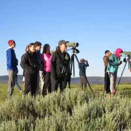
wildlife of Yellowstone, a separate animal-focused itinerary is recommended. Take a break along the route and scan for mountain goats on the peak. Although difficult to spot in the winter months, mountain goats can sometimes be seen on the exposed or wind-blown ridges.
How To Get There :
The Barronette Ski Trailheads are located on both sides of the upper and lower bridges of Soda Butte Creek. To access the lower trailhead, drive east towards Cooke City, Montana, and look for a pullout or parking area on the right side (south) of the road. The trail starts on the opposite side of the parking area and should be marked with a sign. To access the upper trailhead, drive 2.5 miles east from the lower trailhead, and park on the left just before crossing the bridge over Soda Butte Creek. The official trailhead is on the left, a few hundred feet from the parking area.
Barronette Ski Trail Information:
- Length: 3.5 miles (5.6km)
- Rated: Easy
- Elevation Gain: Minimal – Approximately 190 feet (57.9 M)
- Other: The Barronette Ski Trail is not groomed and skier-tracked. The trail is obvious, but pay attention to orange “blaze” markers, especially in the open meadows. If you lose the trail, don’t worry; just follow the creek for a leisurely ski.
- Downloadable Map of Barronette Ski Trail
Both of these trails are accessible year-round and not subject to any seasonal road closures. Cross-country skiing in Yellowstone accesses remote environments with few guest services available. Please be prepared for harsh winter weather and changing conditions. Gardiner, MT, and Cooke City, MT, offer food and refreshments pre- and post-ski. Ski rentals can be found in Livingston, MT, Gardiner, MT, and Mammoth Hot Springs. Guided Cross Country Ski Tours in Yellowstone are also available.
The blog post and trail info were written by Chris Hondorf, owner and guide for Yellowstone Guidelines. Yellowstone Guidelines offers a variety of winter adventures like cross-country skiing, snowshoeing, and wildlife tours. Contact us today –
tours@yellowstoneguidelines.com or 406.599.2960. Hope to see you on the trail!
More Yellowstone Stories